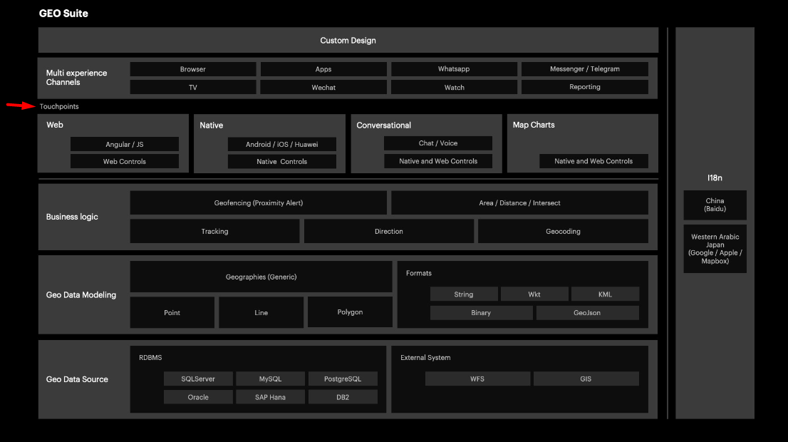
Touchpoints refer to the interfaces available when developing solutions based on geographic components; that is, applications developed using the GeoSuite.
Below you can see the Touchpoints in the GeoSuite marketecture:

It's made up of platforms or platform components, which allow geographic data to be displayed.
This section can answer the following questions, among others:
- How to view Geographic Data
- How to show a map
- How to draw a geometry
- How to view a KML file
These components use controls that, in many cases, allow you to configure which mapping provider you are going to work with, such as Google, Apple, Mapbox, Leaflet, or Baidu.