It refers to the representation of geographic data and the formats (market standards) available when developing solutions based on geographic components—that is, applications developed using the GeoSuite.
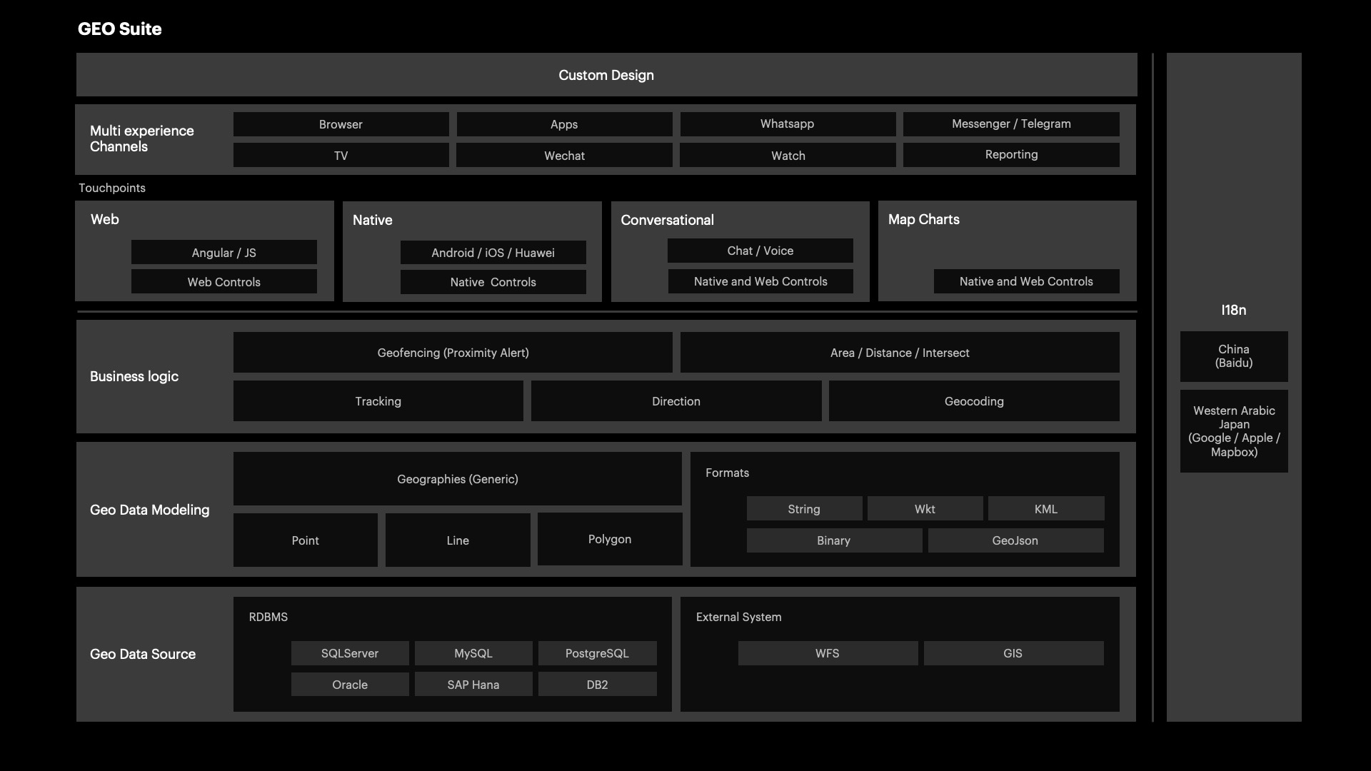
Below are some of the questions that this section can answer:
- How to read a WKT format representation?
- How to read or write a Polygon given by a GeoJSON?
- How to Draw a Polyline?
- How to visualize a KML format representation?
It's made up of data types and functions, methods, or properties that solve these operations.