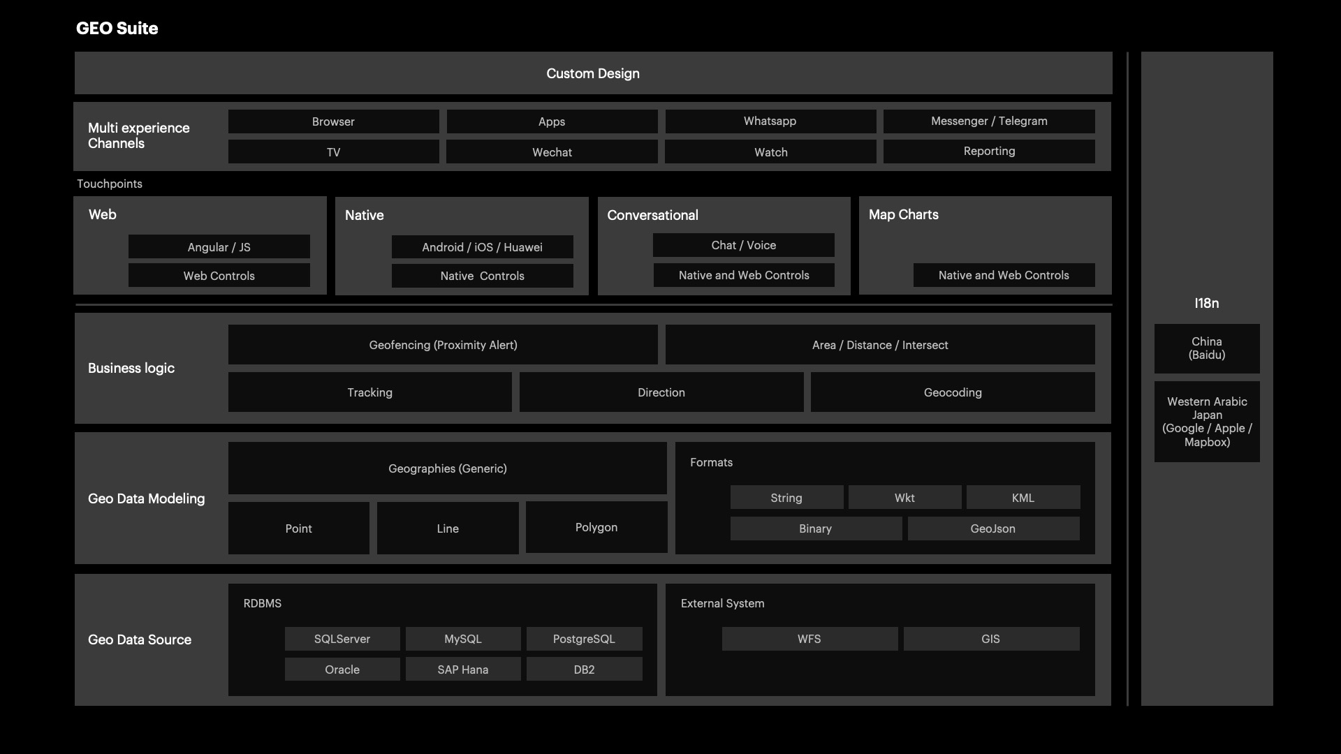
It refers to the functionalities available for developing solutions based on geographic components; that is, applications developed using the GeoSuite.

Below are some of the questions that this section can answer:
- How to get the best route between two points (Direction)
- How to identify if a point belongs to a given polygon (Point in polygon)
- How to trigger an action when the device approaches a certain location (Geofence)
- How to obtain a coordinate from its address (Geocoding)
- How to get my location?
It's made up of functions, methods, or properties that solve these operations with or without a user interface.